
Web app: advanced
Navigate by bus and train
Get from any place to any other by bus and train, with every worthwhile mix of the two to choose from.
Navigate gets you from any place to any other, by bus, train or both, including the walk at each end.
Bus and train, or bus only
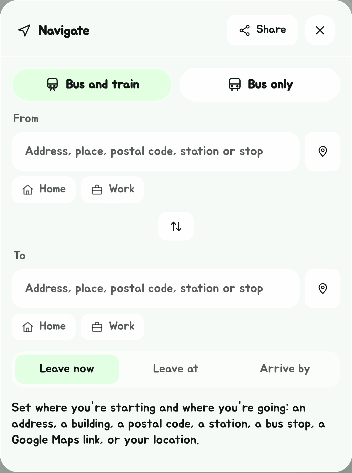
Navigate has two tabs at the top:
- Bus and train, this page: from any place to any other, by every worthwhile mix of buses and trains.
- Bus only, the route planner: between two bus stops, every bus that runs the whole way, or the quickest journeys with a change of bus or a short walk.
Switching tab keeps your two ends where it can: a stop stays that stop, and a place becomes the bus stop at it, or the nearest one within 150 m. The time you picked comes too. The Edge Tray's arrowhead opens Navigate on whichever tab you used last.
Set where you're going
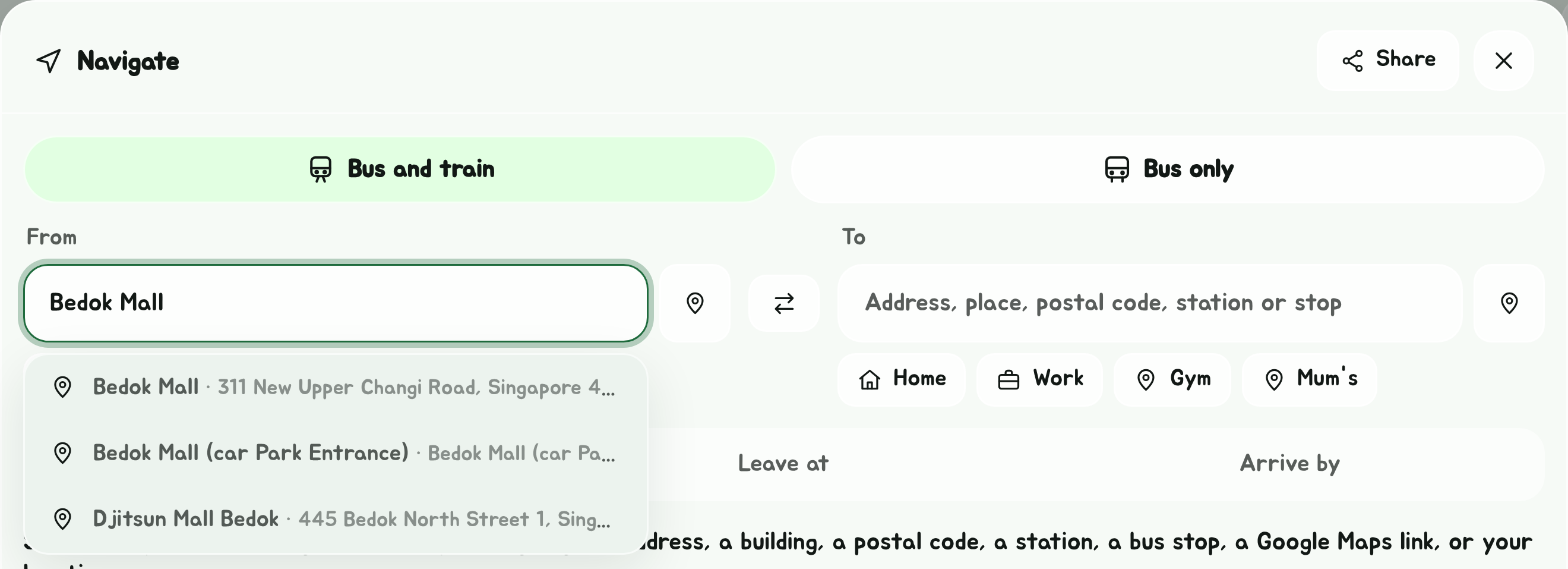
- Tap Navigate, the arrowhead in the Edge Tray.
- In From, type an address, a building, a postal code, an MRT or LRT station, a bus stop, GPS coordinates or a plus code, and pick it from the suggestions. Or tap the pin next to the box to start from where you are.
- Do the same in To.
The swap button between the two boxes turns the journey around.
Stops by any name
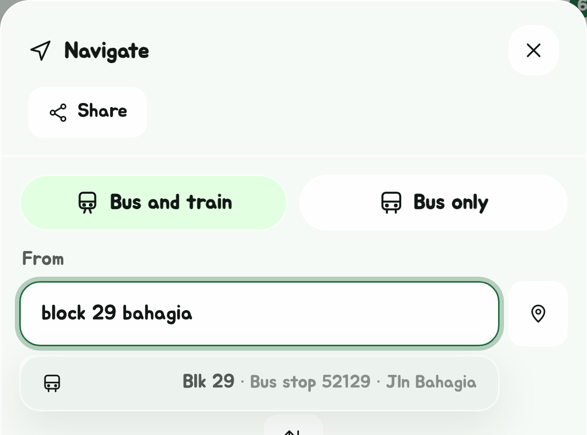
A bus stop is found however you'd search for it: the words in any order, across the stop's name and its road, and the long forms of LTA's short ones, Block for Blk, Jalan for Jln, Opposite for Opp. So finds Blk 29 on Jln Bahagia.
Coordinates and plus codes
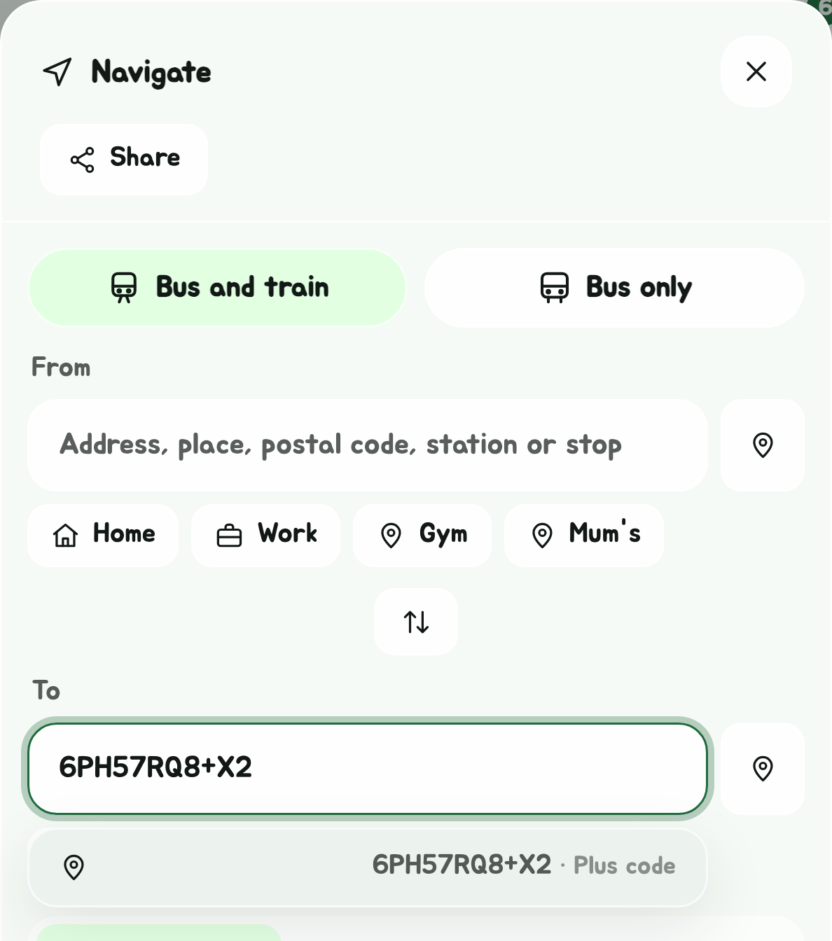
Either end can be a point on the map:
- GPS coordinates, latitude then longitude: , or .
- A plus code, the code Google Maps shows for a place without an address, whole () or short ().
Outside Singapore and the stops across the Causeway, it says so rather than suggesting nothing.
Across the Causeway
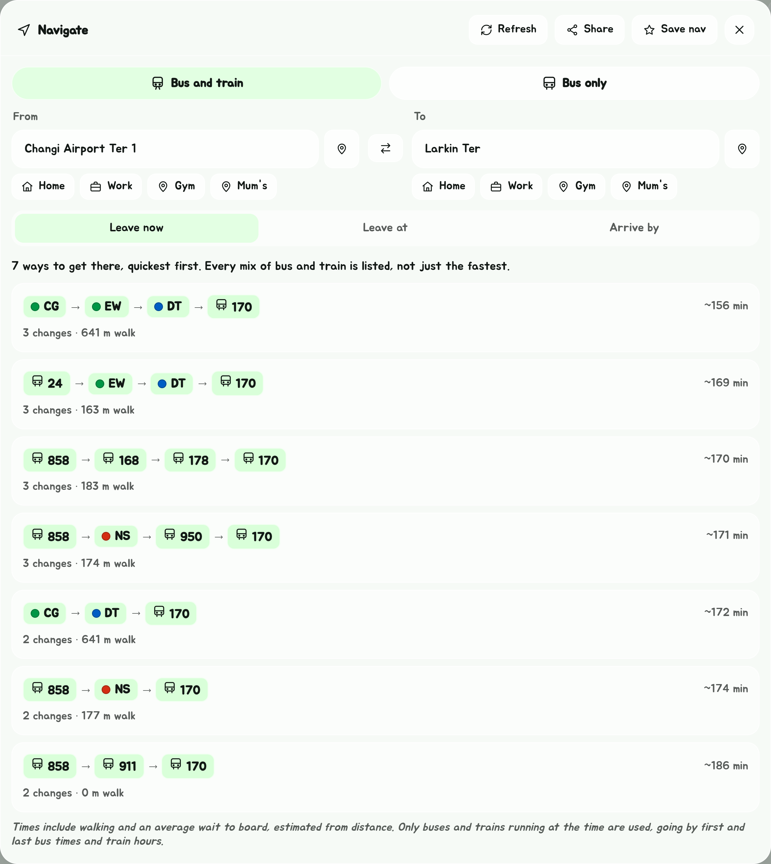
Both ends are in Singapore, or at the stops in Johor Bahru its buses cross the Causeway to: the Johor Bahru checkpoint, JB Sentral and Larkin Terminal. A journey across the border has a MyICA button on the trip bar once it's started: see Get Off Alert.
Crossing, everyone gets off at Woodlands to clear Singapore's immigration, rides any bus across to the Johor Bahru checkpoint, clears Malaysia's, and gets on again (the other way round coming back). Each way across counts time for that, and shows it as a step of its own: about 15 minutes when it's quiet and up to an hour at the rush, by when you'd get there (weekday mornings into Singapore, weekday evenings and Friday nights out to Johor Bahru, Saturday mornings out and Sunday evenings back). If you know how long you usually take, set it in Settings, Immigration time.
Restricted areas
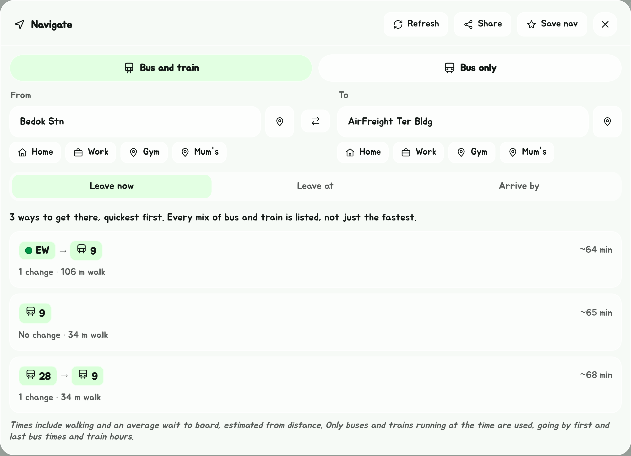
With Settings' Restricted areas set to I have a pass, journeys can also get on and off inside Changi Airport's cargo area and at MINDEF's stops: see Settings.
Home and Work
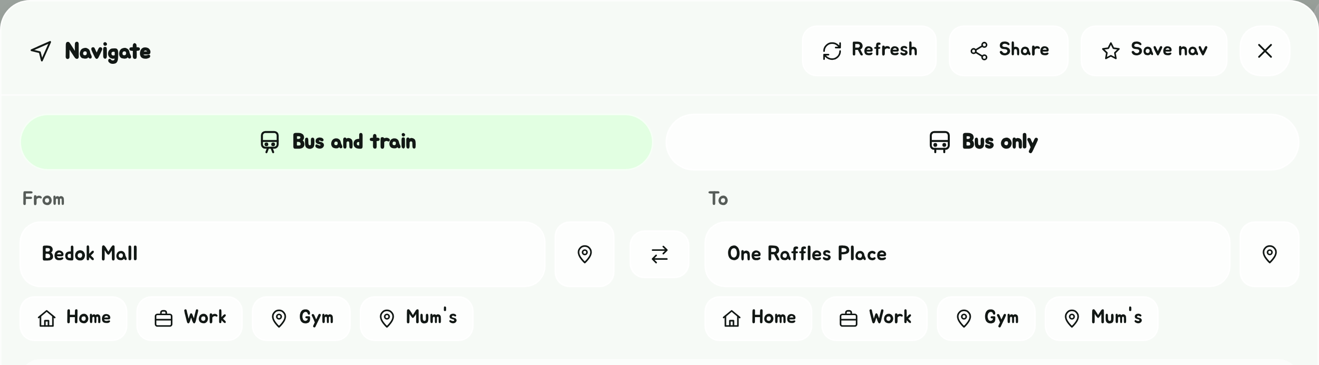
Under each box, Home and Work set that end to the place saved for it, and so does a button for each other place you've saved. Set them in Places; until Home or Work is set, its button is dashed, and tapping it opens Places to set it.
Tapping into either box, before you type, also lists your past searches, your saved places, and your calendar's events, each on its own tab.
Navigate opens in a window over the page. Close it with the button at its top right, or by tapping anywhere outside it. Opening a bus's timings from a way takes you to Bus timings, where Back to Navigate comes back to that same way. Starting a trip closes it too, and the Edge Tray's arrowhead brings it back with the same two places.
From a Google Maps link
Either box also takes a Google Maps link: paste one in, and once it's read the place is set as that end, named as Google Maps names it. Short links () work as well as full ones.
With the app installed on Android, you can also share a place to it. In Google Maps, or on a Google Maps link in another app such as Telegram, tap Share and pick SG Bus Timings. Navigate opens with the place in To; tap the pin by From to go there from where you are.
A link to somewhere outside Singapore, or one with no place in it, says so under the box.
Pick a time
Under the boxes, Leave now is picked to start with. Tap Leave at or Arrive by to plan for another time instead, then pick the day (today or any of the next six) and the time.
- Leave at lists each way with the time you'd set off and roughly when you'd get in, as 08:30 → 09:05.
- Arrive by lists each way with the time you'd have to set off to get in by then. A way you'd have had to leave on already says Too late.
Only buses and trains running at that time are used, for Leave now as well: a bus counts as running between its first and last bus at that stop, for that day of the week, with public holidays counted as Sundays, and trains between about 5:30am (6am on Sundays and public holidays) and midnight. A bus that's stopped for the night, or only runs on weekdays, isn't offered on a Sunday.
Navigate goes back to Leave now each time it's opened, including from a saved nav.
The ways there
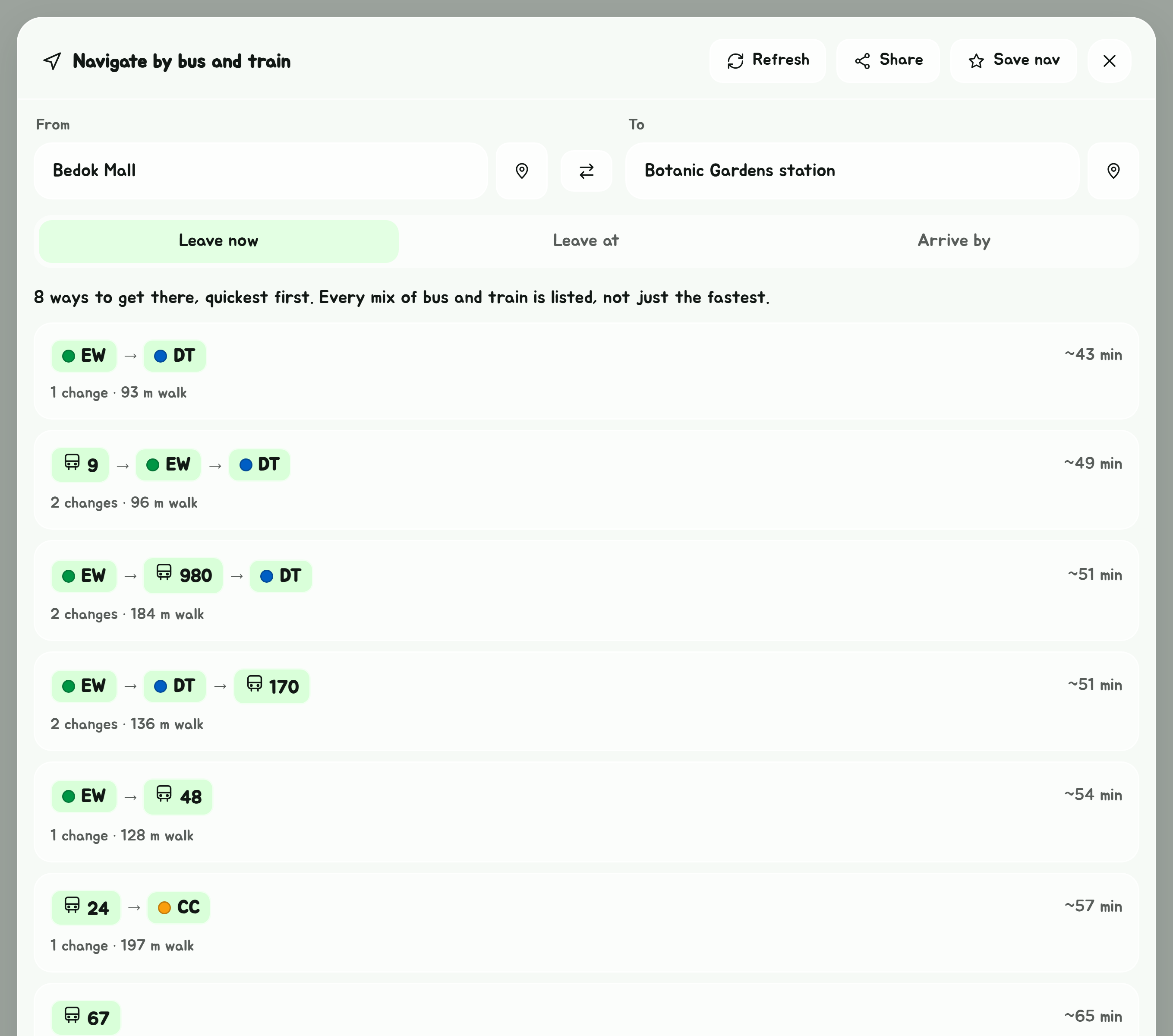
Navigate lists the ways to get there, quickest first. It doesn't stop at the fastest: it keeps the best journey for every mix of bus and train, up to four vehicles, so a train then two buses, or two trains then a bus, is there to compare. A mix that's clearly slower than another of the same kind, and no better in changes or walking, is left out as a detour.
A change can be a short walk to another stop or station, or, at an interchange, terminal or station, a walk of up to 400 m across it, such as Tampines Int to Tampines Stn/Int. Every walk is timed, so a long one only shows up when it's worth it. Staying on a bus into the interchange your next bus leaves from is preferred over getting off early and walking, unless walking is clearly quicker.
Each way shows:
- its trains and buses in order, each train line marked in its colour;
- roughly how long it takes, door to door, walking and waiting included;
- how many changes, and how far you walk;
- OneMap ~42 min, where OneMap's timetable-based planner rides the same way, as a second opinion on the time;
- a warning when LTA reports a disruption on one of its lines;
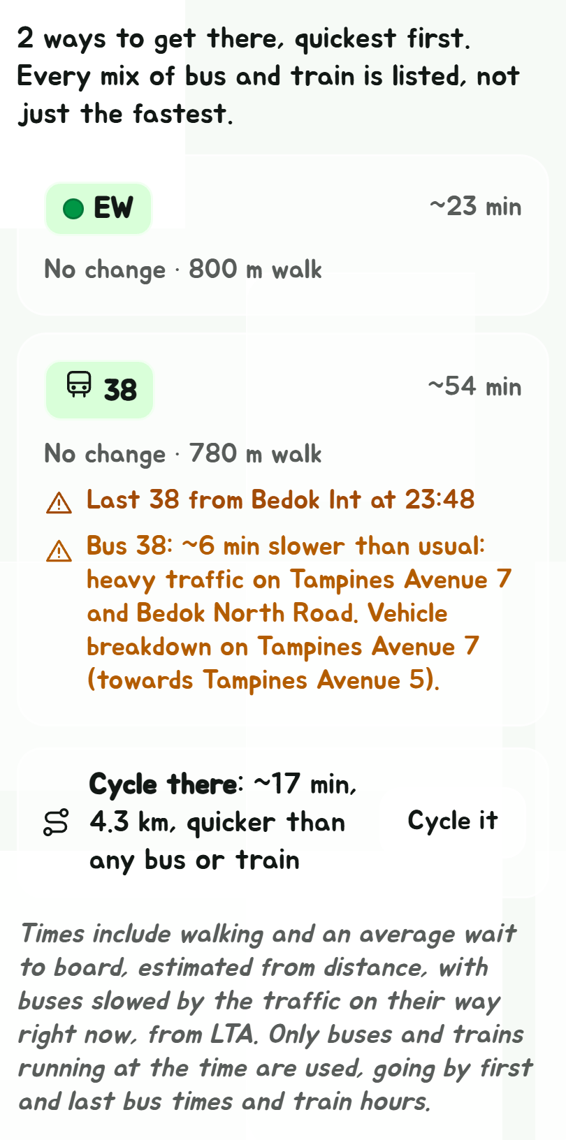
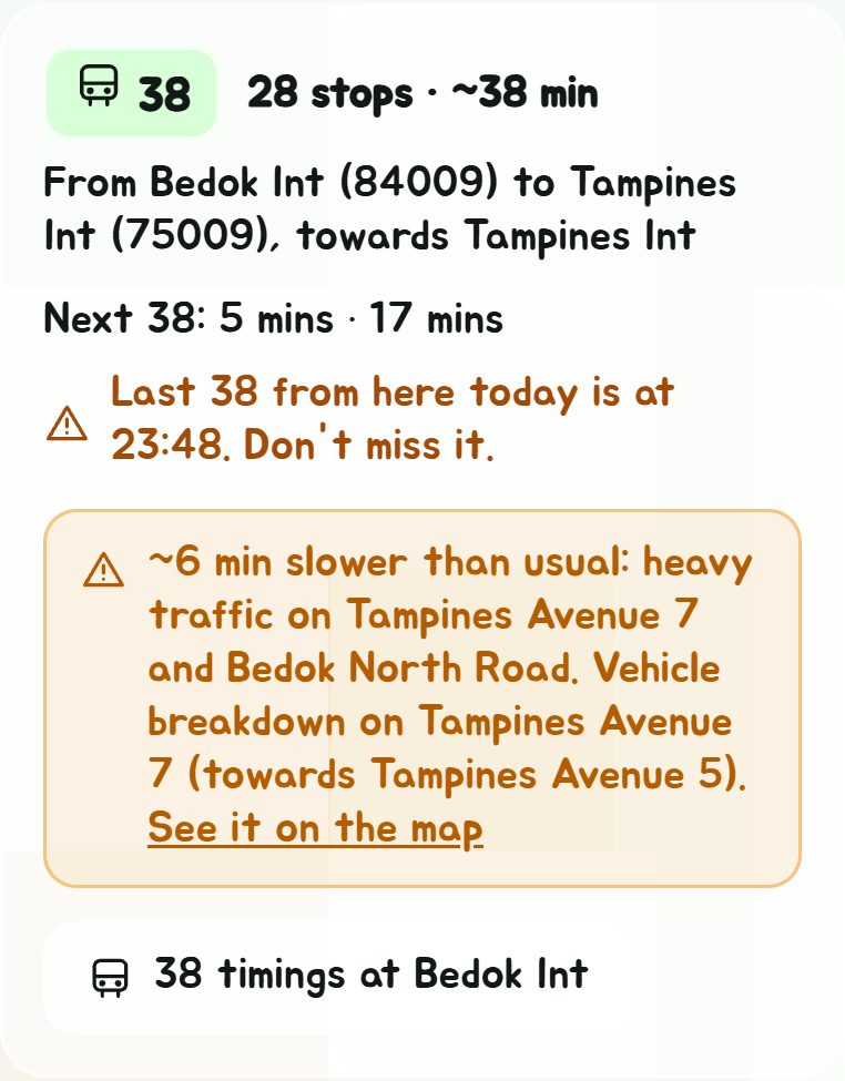
- Last 38 from Bedok Int at 23:48, when you'd catch a bus within half an hour of its last of the day there;
- in orange, a bus slowed by the traffic right now: by how much, and why, the roads by name and any accident or breakdown on its way.
Traffic, walking and cycling
Setting off now, bus times allow for the traffic right now: LTA's live speeds on every road, updated every five minutes, and its accidents, breakdowns and roadworks. A bus through a jam takes longer, so a train or another bus can come out quicker, and the list says why.
Under the ways, Walk there says how long walking the whole way takes, where it might compete, and Cycle there how long cycling takes, with Cycling set to I have a bike in Settings. Below them, Drive there says how long driving takes, by Singapore's roads. Each says when it's quicker than any bus or train. Walk it, Cycle it and Drive it show the way on the live map. Walks go along footpaths too, through estates, void decks and linkways, not only along roads, and along a road where there's no footpath to the place at all.
No timetables are published for trains, so train times are estimates from the distance between stations, with an average wait to board. OneMap's time, where shown, comes from timetables.
Shuttle buses
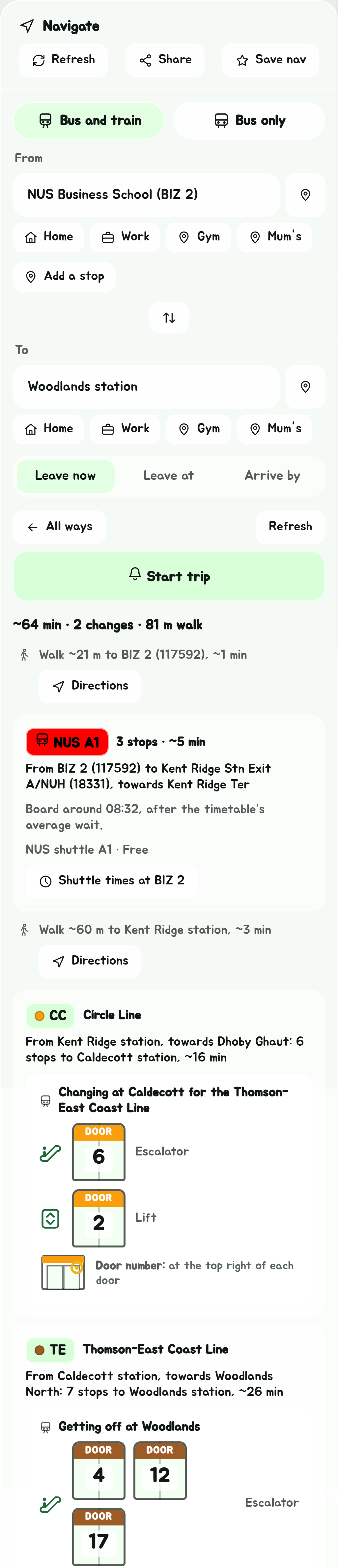
Ways can ride a shuttle bus too, NUS's and NTU's and the island's others, so a way can start at PGP or end at IKEA. A shuttle's leg is in its route's colour, with whose it is, NUS A1, and what it costs. Its wait to board is the timetable's average wait then: half the time between its buses. A shuttle that isn't running then isn't used. Between stops it's timed at about 15 km/h.
- Free only, the default for Shuttle buses in Settings, uses only the free ones. Free and paid adds the rest, such as Mandai's and the TS1 to Johor Bahru.
- A hotel's or a condo's shuttle is only used on a way that starts or ends there.
Open a way
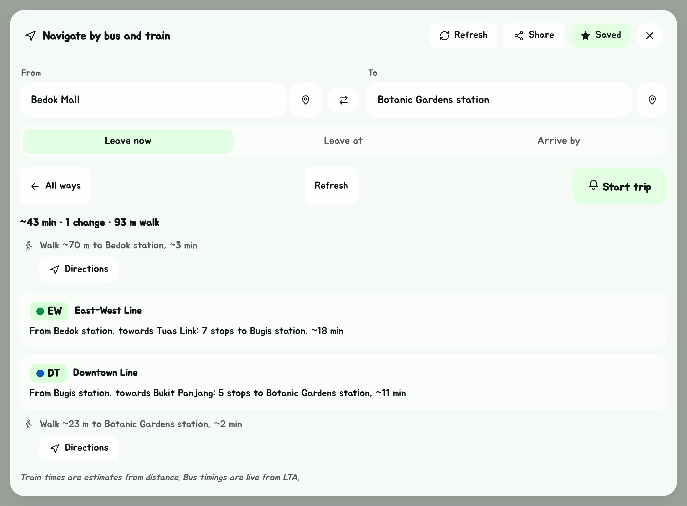
Tap a way to see it part by part:
- Walks, with the distance and roughly how long. Directions opens the walk on the live map, or in Citymapper. A walk to or from a station goes by its nearest exit.
- Trains, with the line, the direction to take (towards its last station), how many stops, and where to get off. For almost every MRT station, it also says which door to stand at.
- Buses, with how many stops, where to get off, and the live timings of that bus at the stop you board it. A button opens that stop's timings for the bus, with Back to Navigate on them to come back. If you'd be catching one of its last buses of the day, it says when the last one is. If traffic slows it, an orange box says by how much and why; tap it for the bus's road on the live map, orange where it's slow and red where it's jammed.
The nearest exit
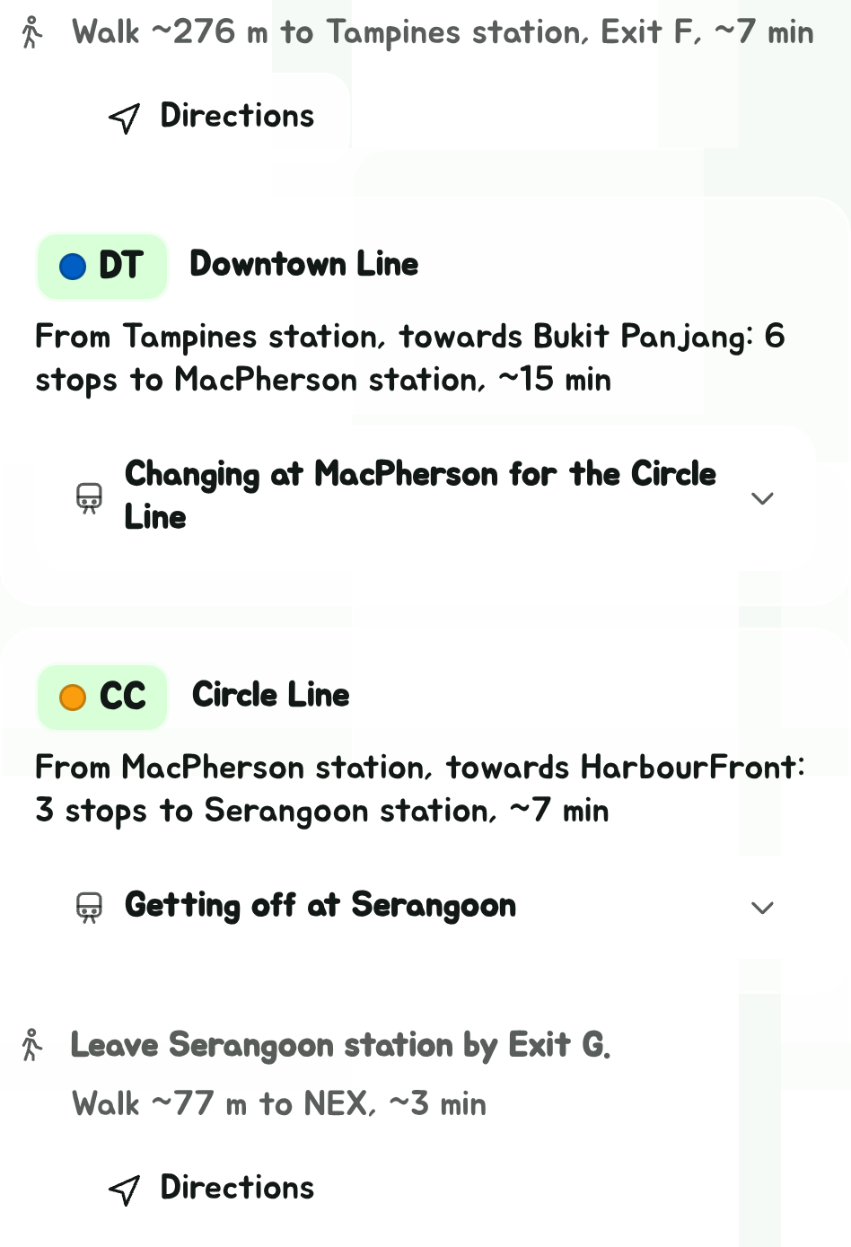
A station has several exits, often a few hundred metres apart. A walk to a station goes to the exit nearest where you start it, and says which: Walk ~276 m to Tampines station, Exit F. A walk out of a station starts with which exit to leave by, the one nearest where you're going: Leave Serangoon station by Exit G. A walk from one station to another goes between the two exits nearest each other.
Directions goes to or from that exit, not the middle of the station, and so does a trip started from the way, so the live map and the Get Off Alert walk you to the right exit.
Which door to stand at
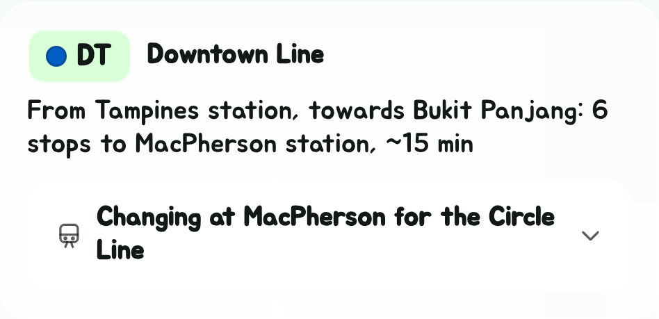
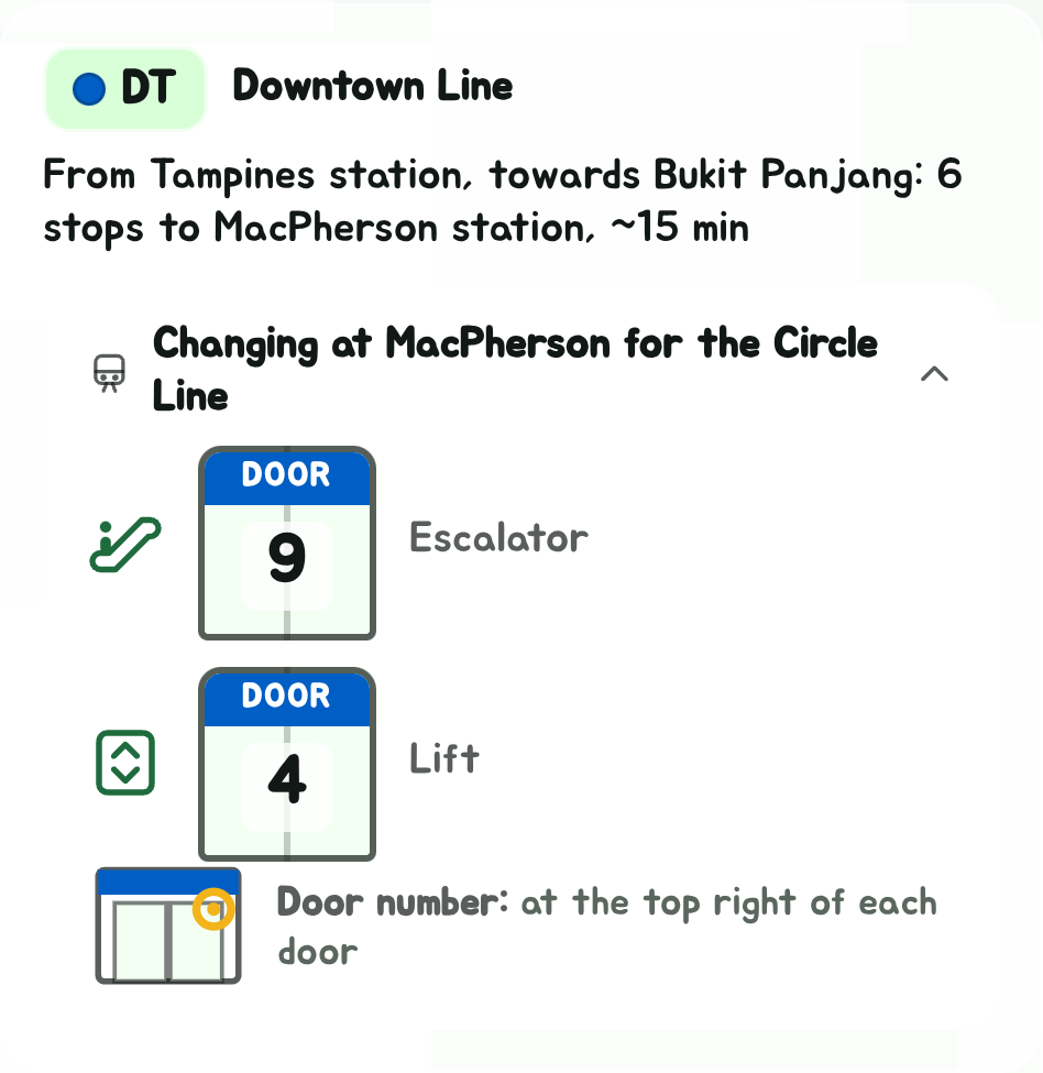
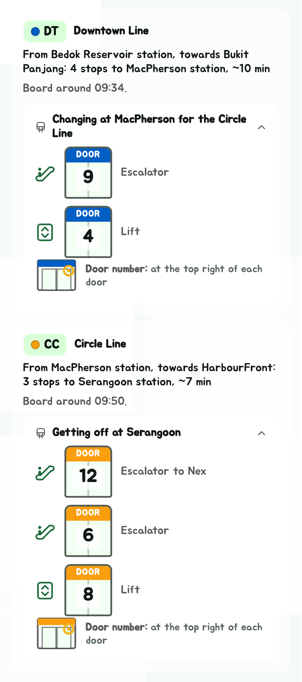
Under a train ride, a panel says where on the train to stand. It starts folded to one line, such as Changing at MacPherson for the Circle Line or Getting off at Serangoon, so the rest of the way isn't pushed down the screen. Tap that line to open it, and again to fold it. It stays as you left it while the way's live timings come in or you tap Refresh. In Explorer, a station's doors are always shown.
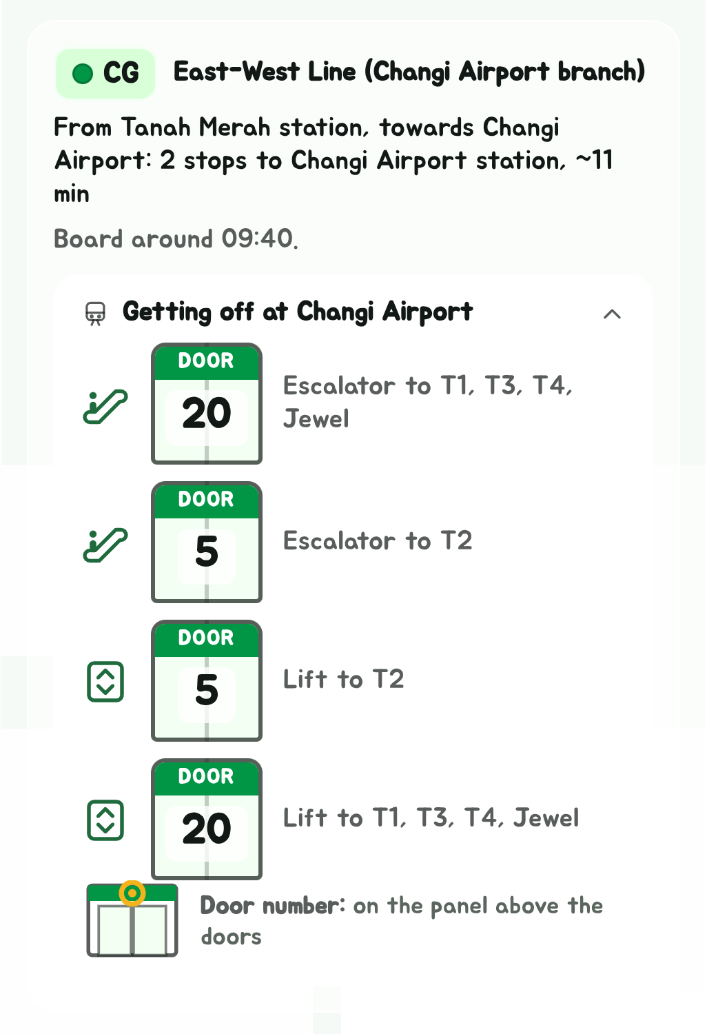
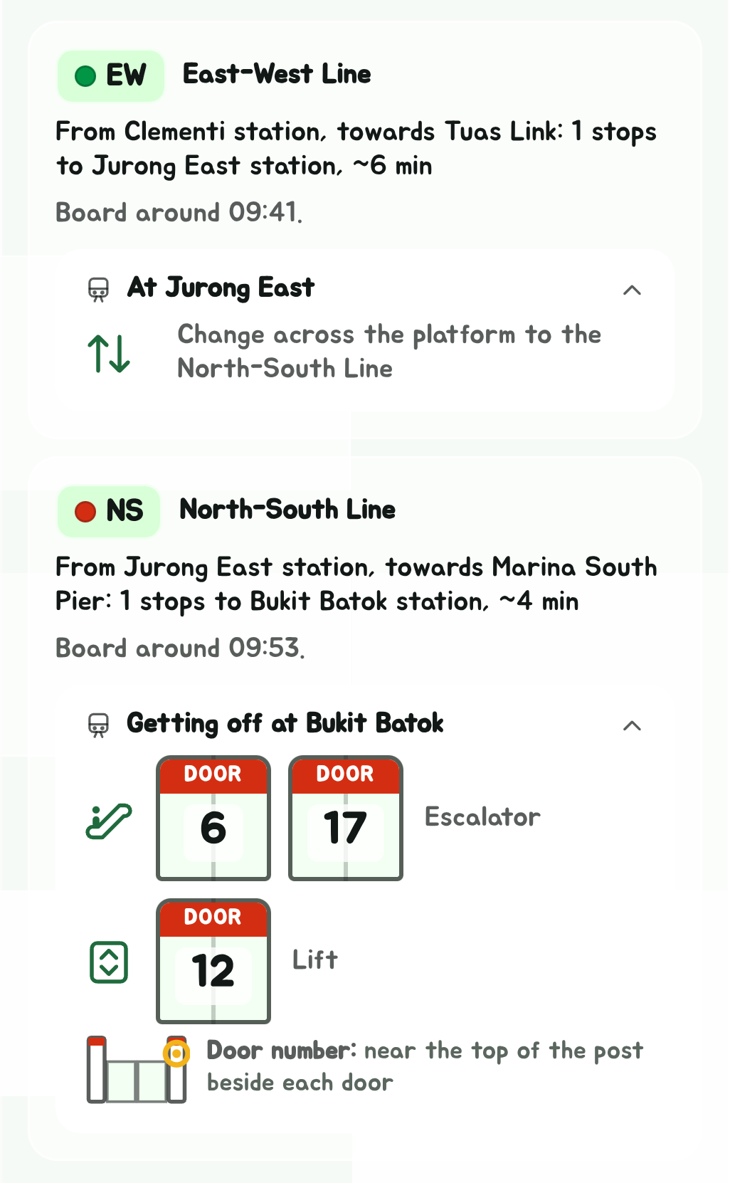
Opened, each way off the platform has a row: its icon (escalator, lift or stairs), the doors that stop nearest it, and where it leads. Each door is drawn as a little platform door in the line's colour with its number on it, the same number the real platform door has, so you can walk along the platform to it.
Where that number is depends on the door, so the last line of the panel shows it, with a little drawing of the door:
- On the panel above the doors, at the North-South and East-West lines' underground stations.
- At the top right of each door, on the North East, Circle, Downtown and Thomson-East Coast lines.
- Near the top of the post beside each door, at elevated stations, whose platform doors are half-height.
Where it isn't known which, it says to look for the number on each platform door.
- Getting off, it's the ways out of the station, with the mall or terminal one leads to where it's somewhere in particular: Jewel, Nex, City Square.
- Changing lines, it's the way to your next train instead.
- Your next train across the platform, it just says so.
A few stations don't have their doors in yet, and a ride ending at one shows no panel.
With a time picked, each bus and train also says roughly when you'd board it. Live timings only reach about half an hour ahead, so for a way setting off later than that, each bus says when you'd board it instead, counting an average wait, and its live timings show up from half an hour before you set off.
All ways goes back to the list, and Refresh beside it updates the way's live bus timings.
Refresh at the top of the window, there once both ends are set, plans the ways again, with any new disruptions and the time now. With a way open, it updates that way's live timings too.
Start trip follows you along the way and buzzes two stops before each change and the end: see Get Off Alert.
Save it

Tap Save nav to add it to your favourites, under Navs. Like routes, a nav and its reverse are two separate favourites.
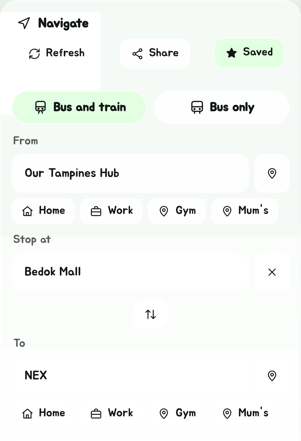
With a stop on the way (Add a stop, under From), the nav is saved with its stop, and opening it from Favourites puts the stop back. So Home to Work and Home to Work by way of the gym are two favourites, and Favourites shows the second as Home → Gym → Work. A saved nav and its stop sync to your other devices and the Telegram bot.
A saved nav doesn't keep a time.
Share it
Tap Share at the top of Navigate, and pick what to send:
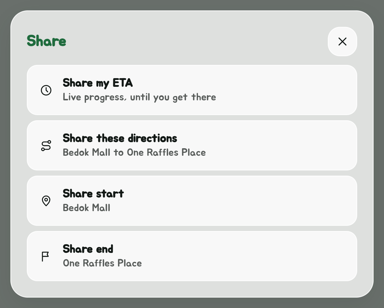
| Pick | Sends | The link |
|---|---|---|
| Share my ETA | On a trip: when you'll get there, and how far along you are, live | |
| Share these directions | Both ends, the time if you picked one, and the way you have open | |
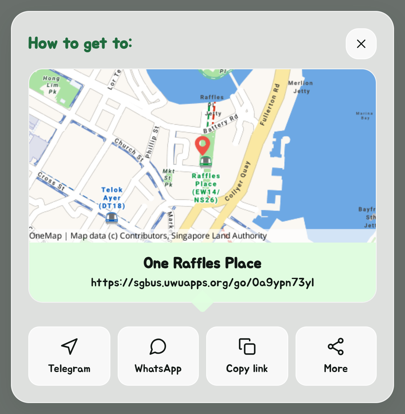
| Share start, Share end | "How to get to" that place |
Each opens a card with a map and the short link, and buttons to send it with Telegram or WhatsApp, copy it, or, on a phone, open your share sheet with More. In a chat, the link shows its map and what it is. In the Android app, Telegram and WhatsApp open straight in the app, ready to pick a chat, without going through the browser, and Offline Sharing sends it to a phone next to you with no internet, by holding the phones together.
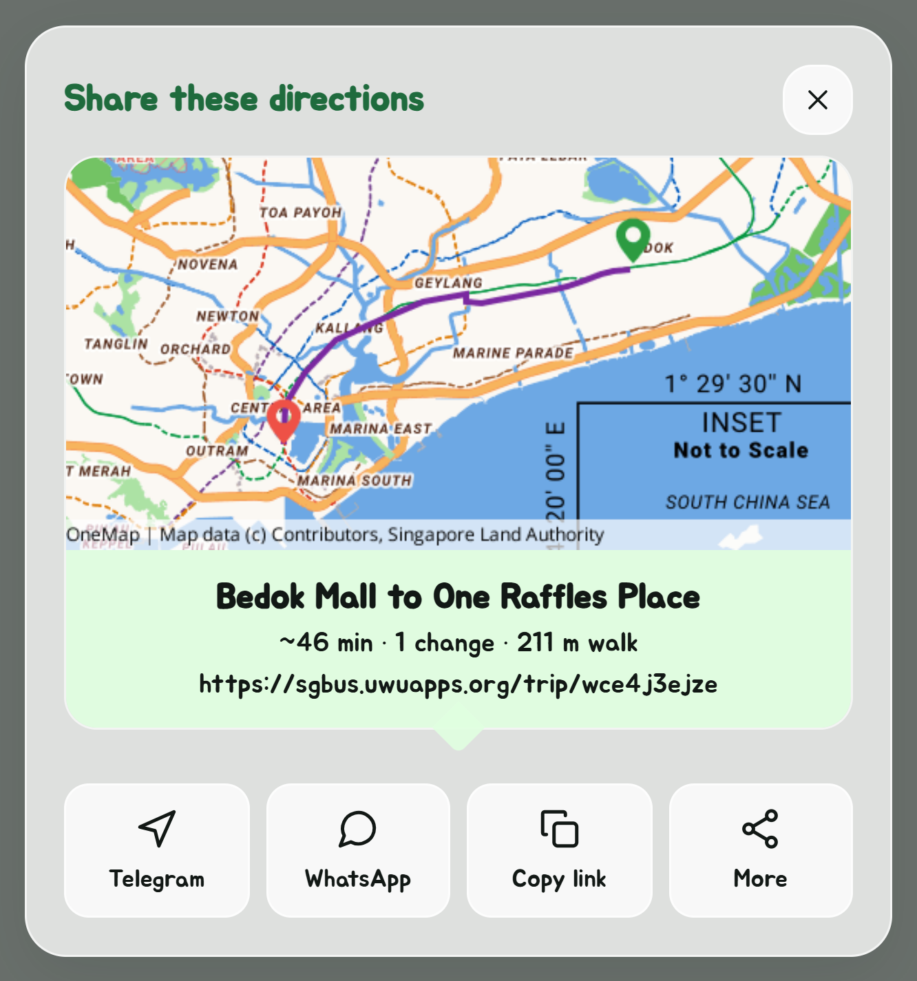
- A directions link opens Navigate with the same two places and time, and the same way open if it still runs.
- A start or end link opens Navigate from wherever the person opening it is, to that place.
- An end set to Your location isn't sent as where you are: in a directions link it becomes the location of whoever opens it, and shared on its own it's sent as My location, for meeting up.
Sharing the same place or directions again gives the same link. With nothing set yet, Share sends a link to Navigate itself, and the address of the page changes to the nav as you go, so you can also bookmark it.
Share my ETA
On a trip, Share my ETA, here or on the trip bar, gives a link to your live progress: "Sam will arrive in 12 min", around what time, which bus or train you're on and how many stops are left, and a map with where you've got to on the route. The name is the one in Settings, if you set one.
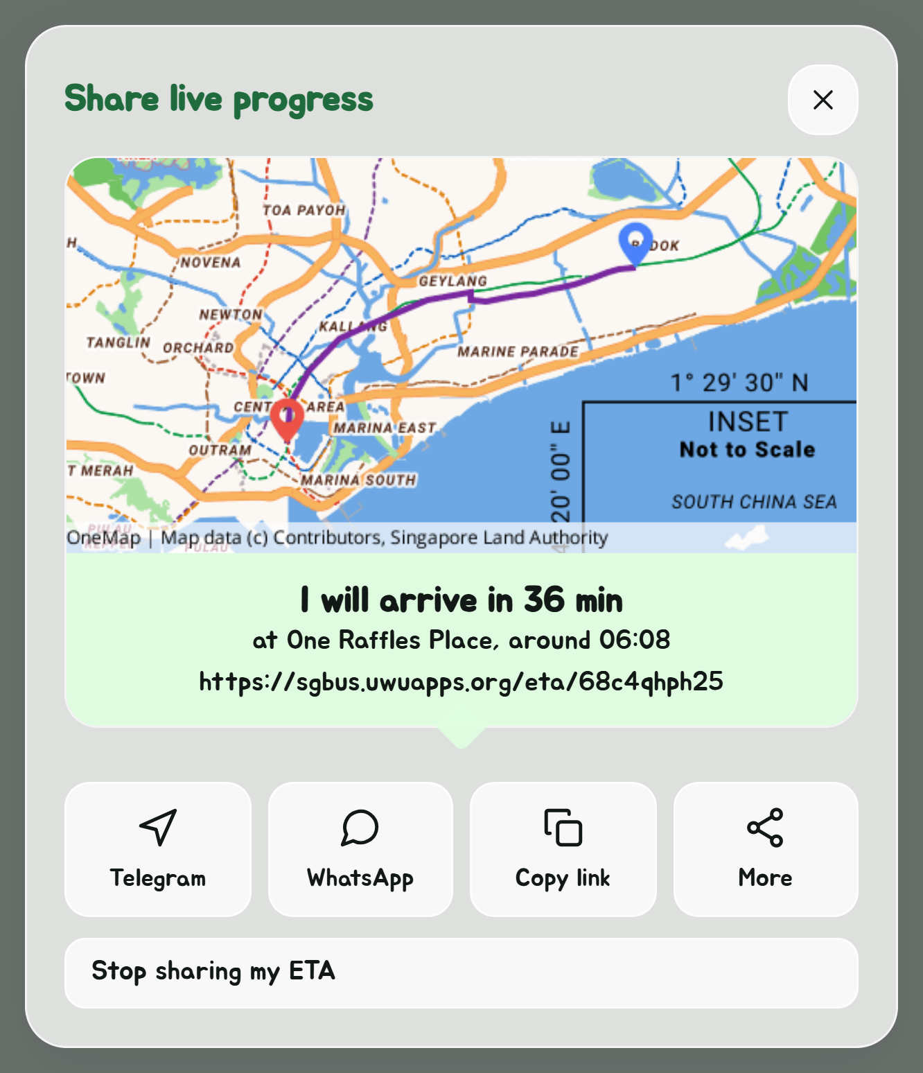
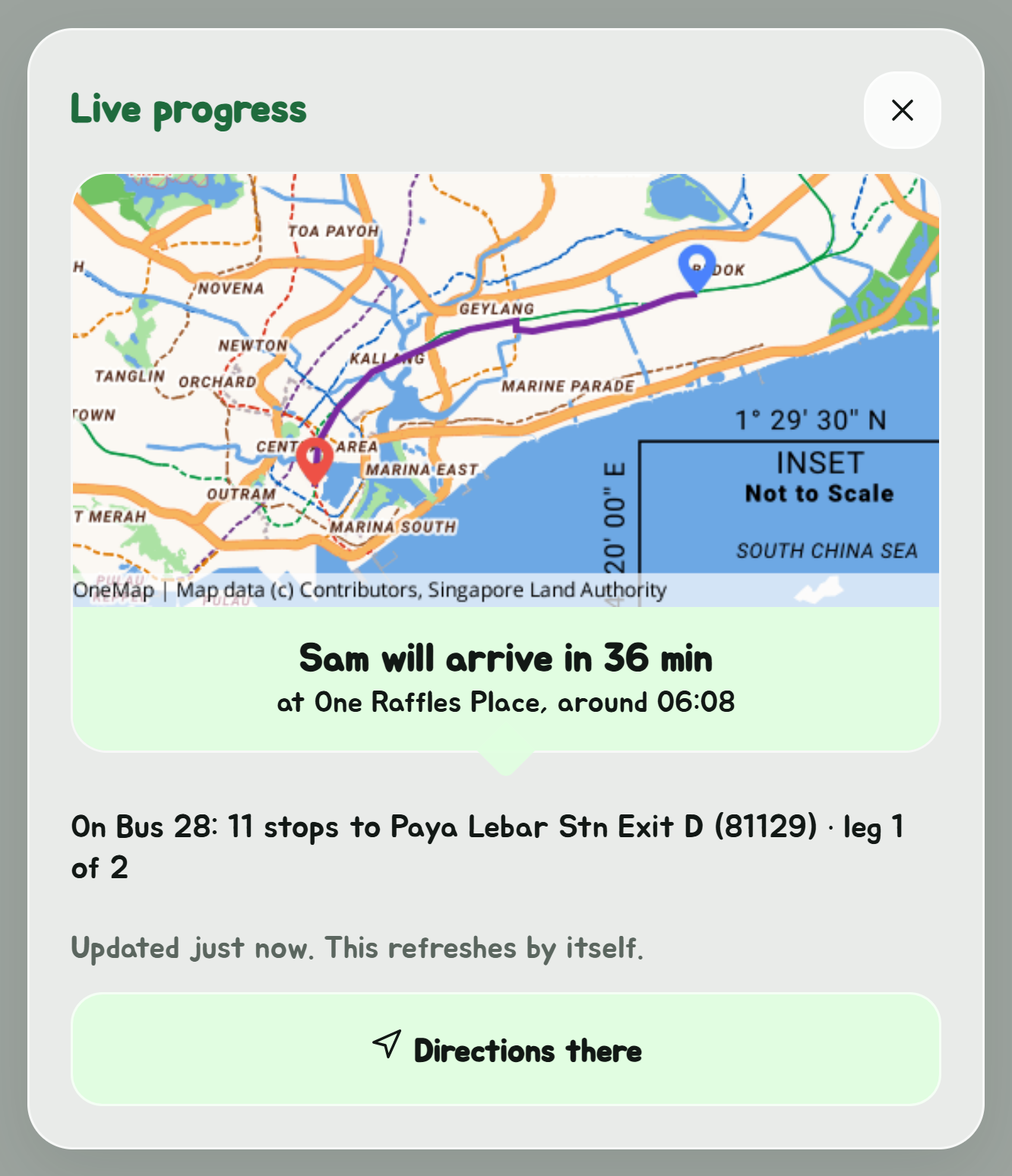
Whoever opens it sees it update by itself. The app sends your progress every half minute while it's open. With notifications allowed for the Get Off Alert, the server carries on from LTA's bus positions and the clock while the app is in the background. The link says when it was last updated, and that the arrival time is the last estimate if it's been a while.
It ends when you arrive or end the trip, or when you tap Stop sharing my ETA on its card. The link stops working three hours after its last update.
Under it, Follow in Telegram opens the same trip in the Telegram bot, as a live card in your own chat with it.
Also in Telegram
The Telegram bot's asks the same planner, so it finds the same ways.