Web app: advanced
Explorer
Every bus stop and MRT and LRT station on the live map, with a stop's buses or a station's doors a tap away.
Explorer is the live map with nothing to follow: every bus stop and every MRT and LRT station round you, each a dot you can tap. An interchange is a pill instead, in each of its lines' colours: green, red, purple, orange, blue, brown and the LRT's grey, always in that order. Open it with the map button in the Edge Tray.
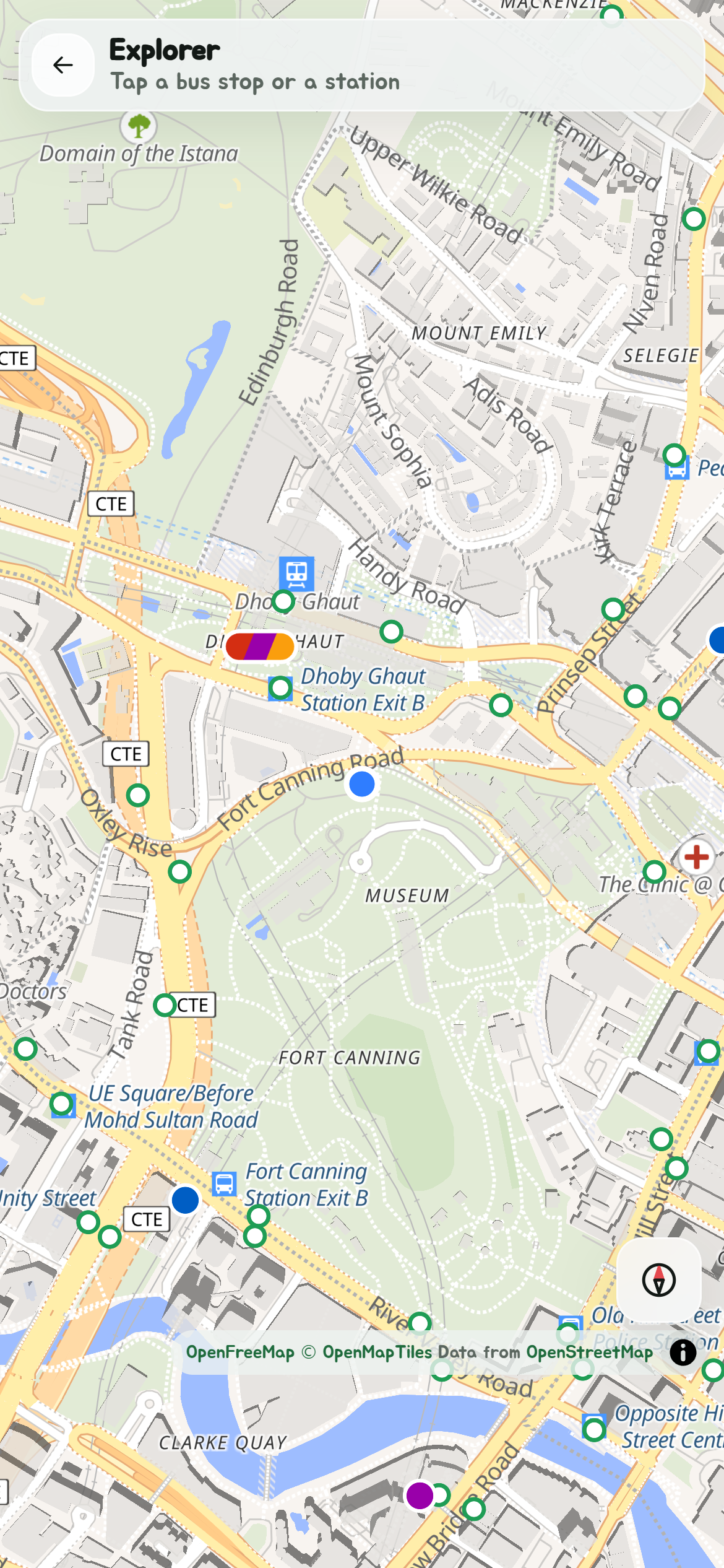
The first time it opens, a short tour shows you round; Show me around in Settings shows it again. It opens on you, close enough in to see the stops round about, and follows you as you move. Drag or zoom to look further; Recentre comes back to you. The stations show from further out, the stops once you're close in. The compass button turns the map with you, as on the live map.
A bus stop
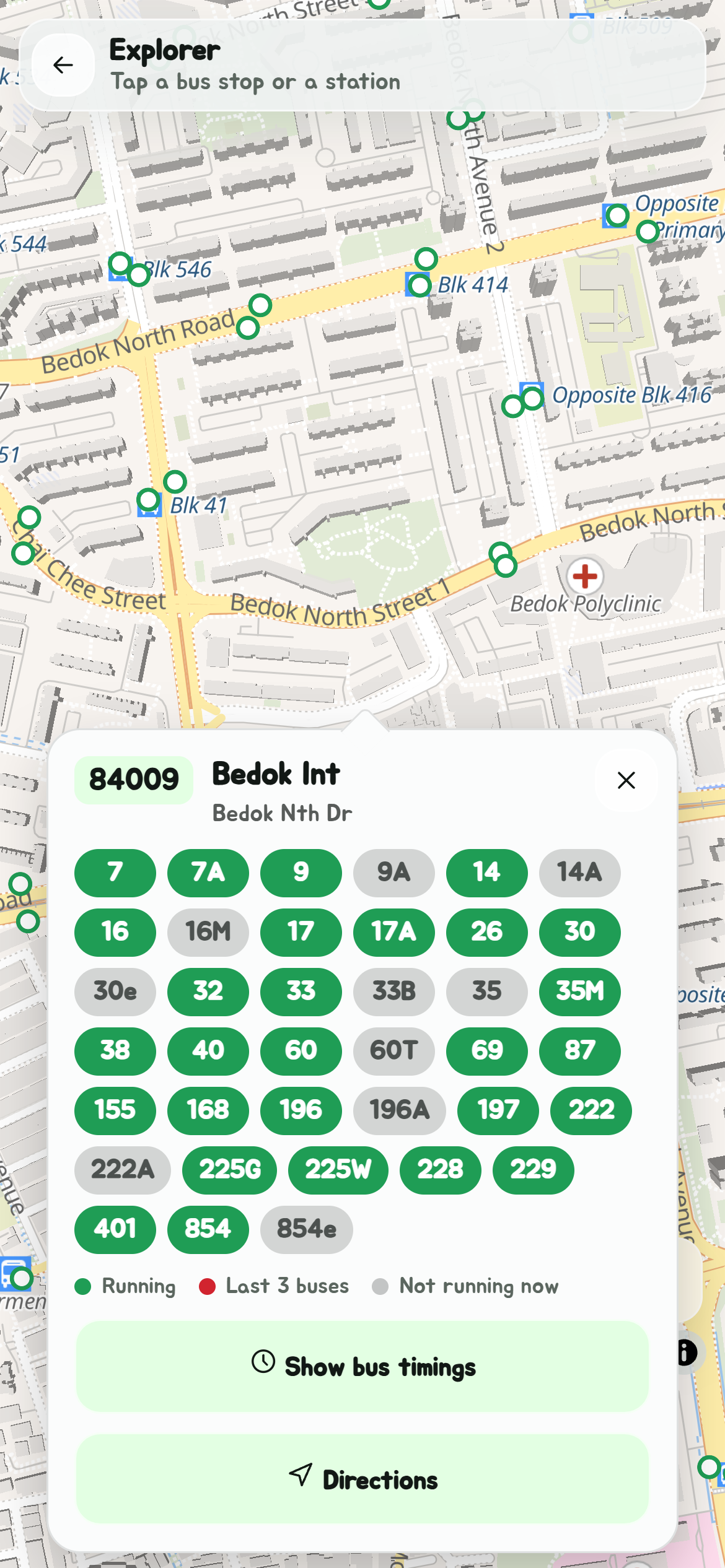
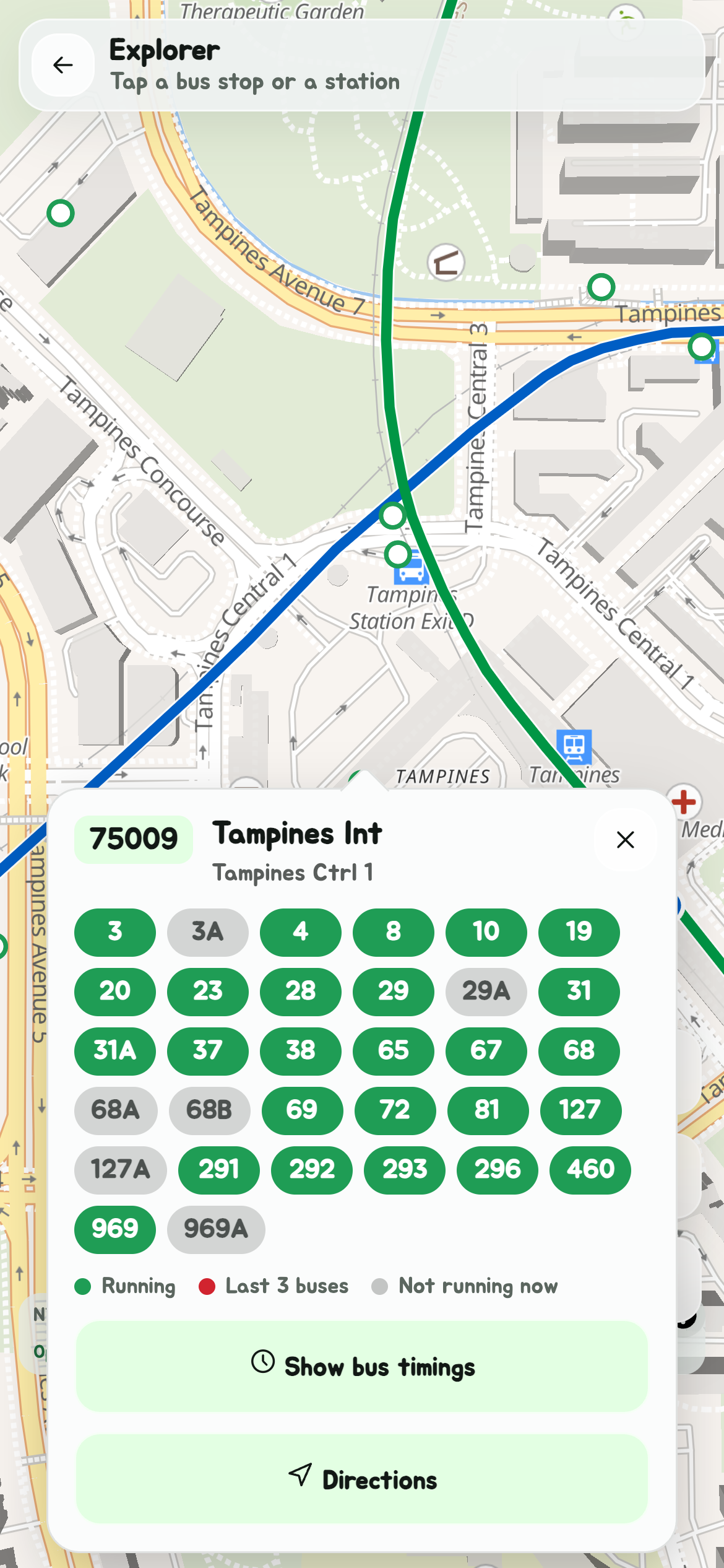
Tap a stop and its card opens from the dot: its number, its name and road, and a pill for every bus that stops there:
| Pill | Means |
|---|---|
| Green | Running now. |
| Red | Running, but down to its last three buses of the day here. |
| Grey | Not running now: before its first bus or after its last today, or not on today at all. |
Running is by each bus's first and last bus at that stop today, with its live timings to tell when only the last few are left. Tap a bus's pill for that bus's timings at the stop, on Bus timings.
Show bus timings, under the key, closes the map and opens the stop's timings on Bus timings, as a search would.
A station
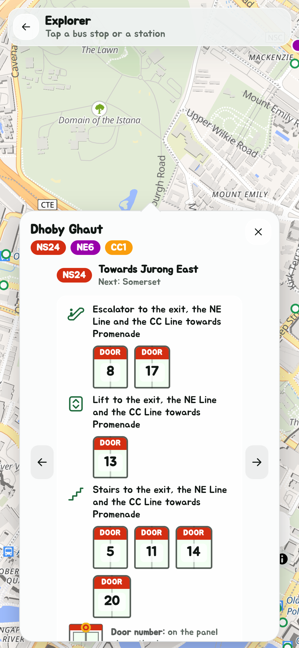
Tap a station for its card: its name and its codes, each in its line's colour, then one platform at a time. Each says which way its trains go and the next stop, then the doors to stand at for the escalators, lifts and stairs, and where each leads: the exit, another line, or a mall or terminal. The door number is the one on the platform door, and the card shows where on the door to find it, as Navigate does.
Tap the arrows at the sides, or swipe across, for the station's other platforms, the way each line goes.
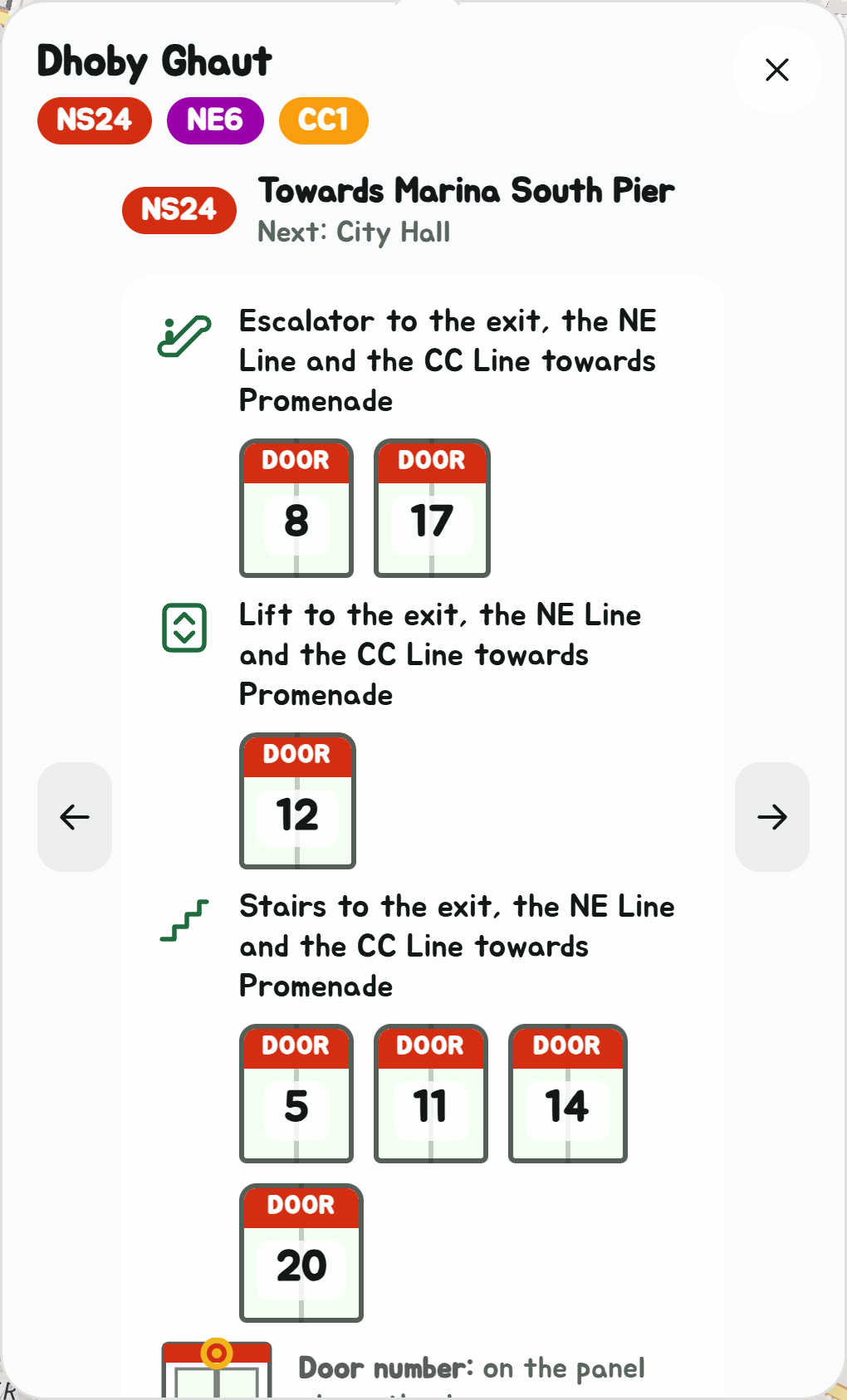
A station with no door details yet says so. Its name, codes and Directions are still there.
Shuttle buses
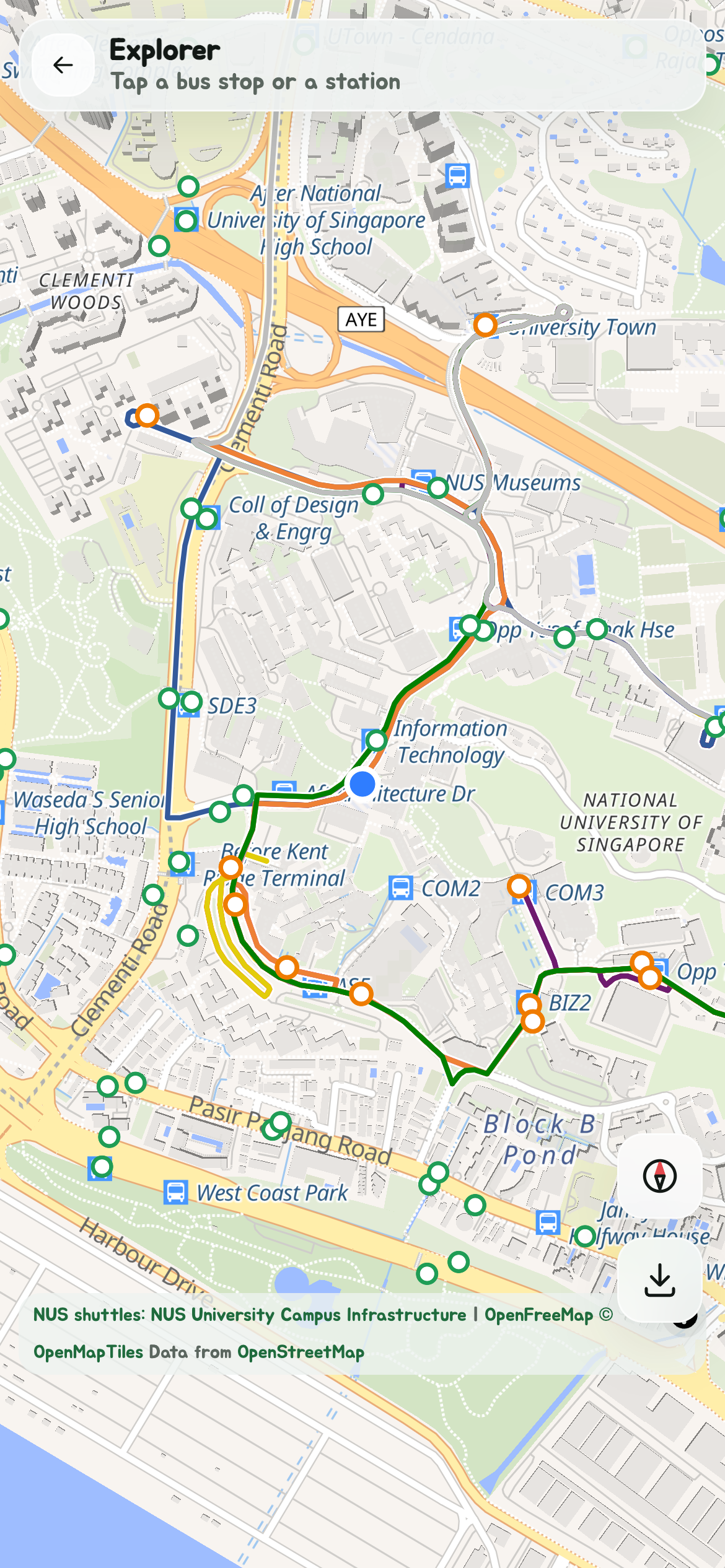
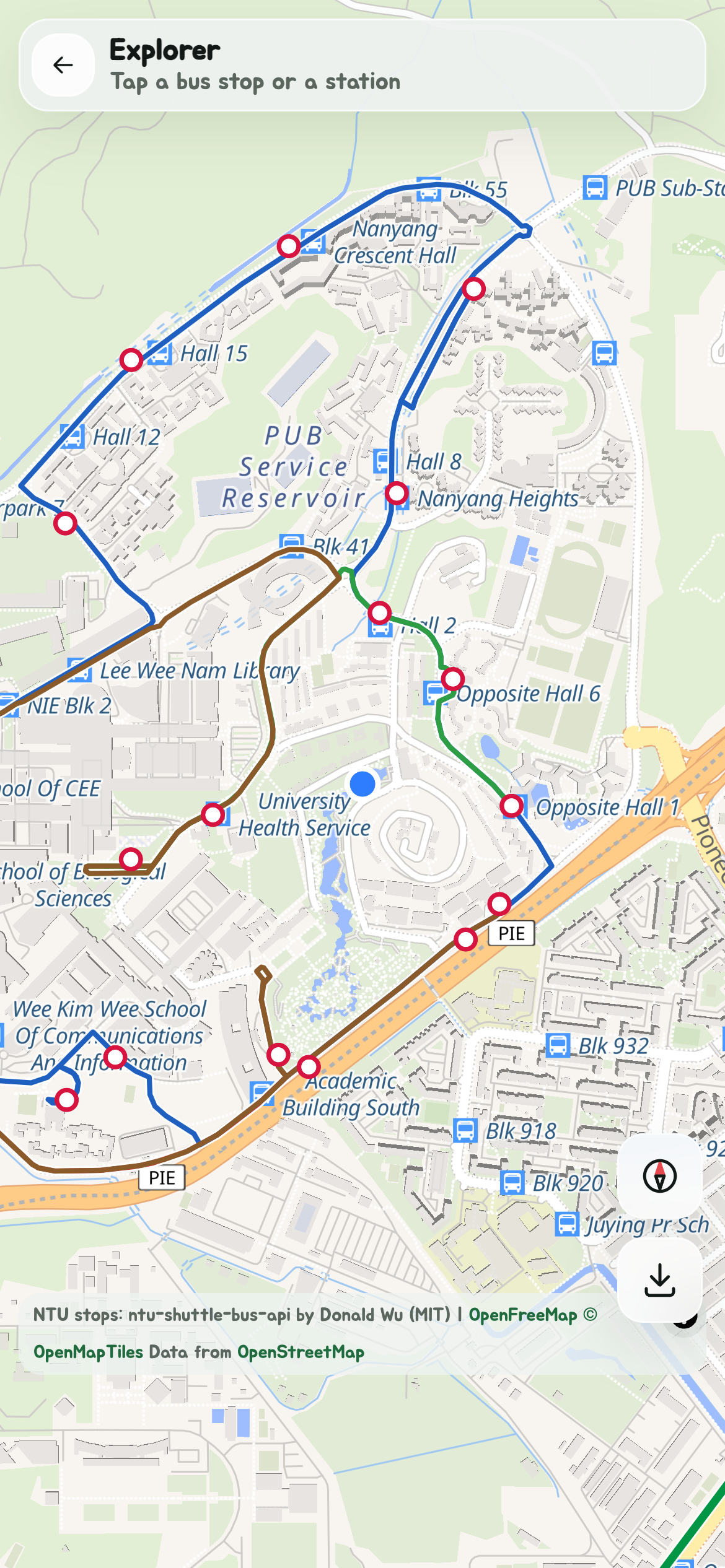
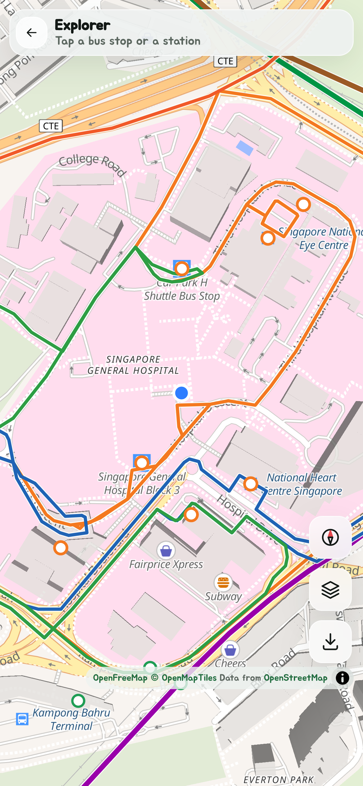
Shuttle buses are on Explorer too, NUS's and NTU's and the island's others (the list): each route a thin line in its colour, along its roads, and each stop of their own a white dot edged in the operator's colour, orange for NUS and red for NTU. Tap one for its card: every shuttle route there, with what its timetable says now, such as Every 4–6 min, the next departures from where it starts, or when the next bus is, and the next bus live where the operator shows it. Paid ones, such as Mandai's and the TS1, show with Shuttle buses on Free and paid in Settings.
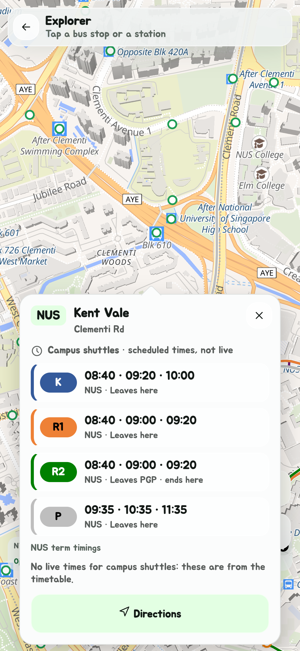
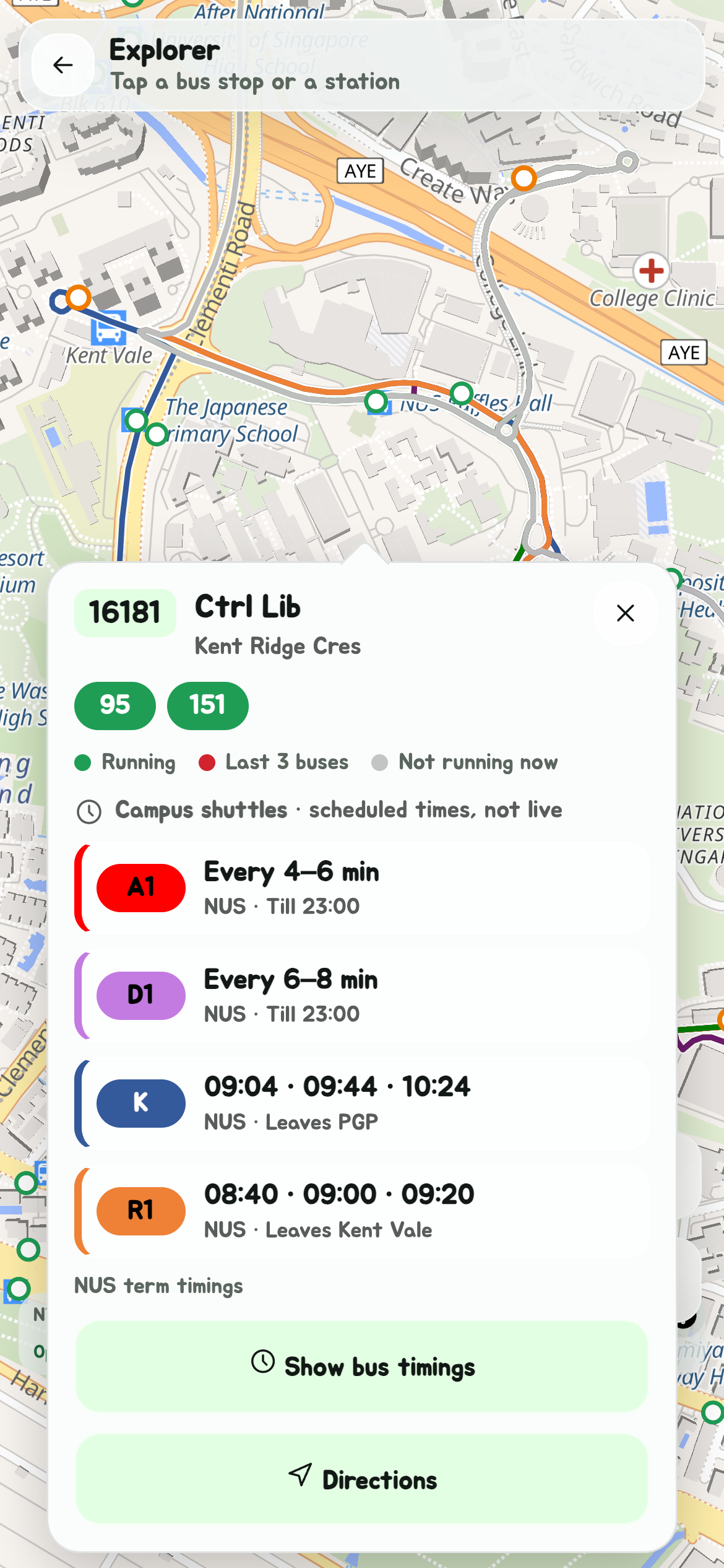
A campus stop that public buses use too is the usual stop, drawn once: its card has the buses and the shuttles both, and Show bus timings lists them both too.
Directions
Every card ends with Directions. It closes the map and opens Navigate on Bus and train, from where you are to that stop or station.
Back where you left it
Leave Explorer by a card's Show bus timings or Directions, and the next time you open it, it's back on that stop or station with its card open, though you've moved, so you can carry on where you were. Close Explorer yourself, with its back arrow, and it forgets: next time it opens on you.
On a trip or a walk
The stops and stations drawn on your trip, and the stop a walk goes to, open the same cards when you tap them.
Layers
Choose what Explorer shows with Layers, the stacked-sheets button with Explorer's other buttons at the bottom right. Tap a layer to turn it off or back on:
- Bus stops
- MRT and LRT stations
- MRT and LRT lines
- Shuttle bus routes, the shuttle buses' routes
- Shuttle bus stops, the shuttles' stops that aren't LTA bus stops
The map changes as you tap. Your choice is kept on this device for next time.
Save the map for offline
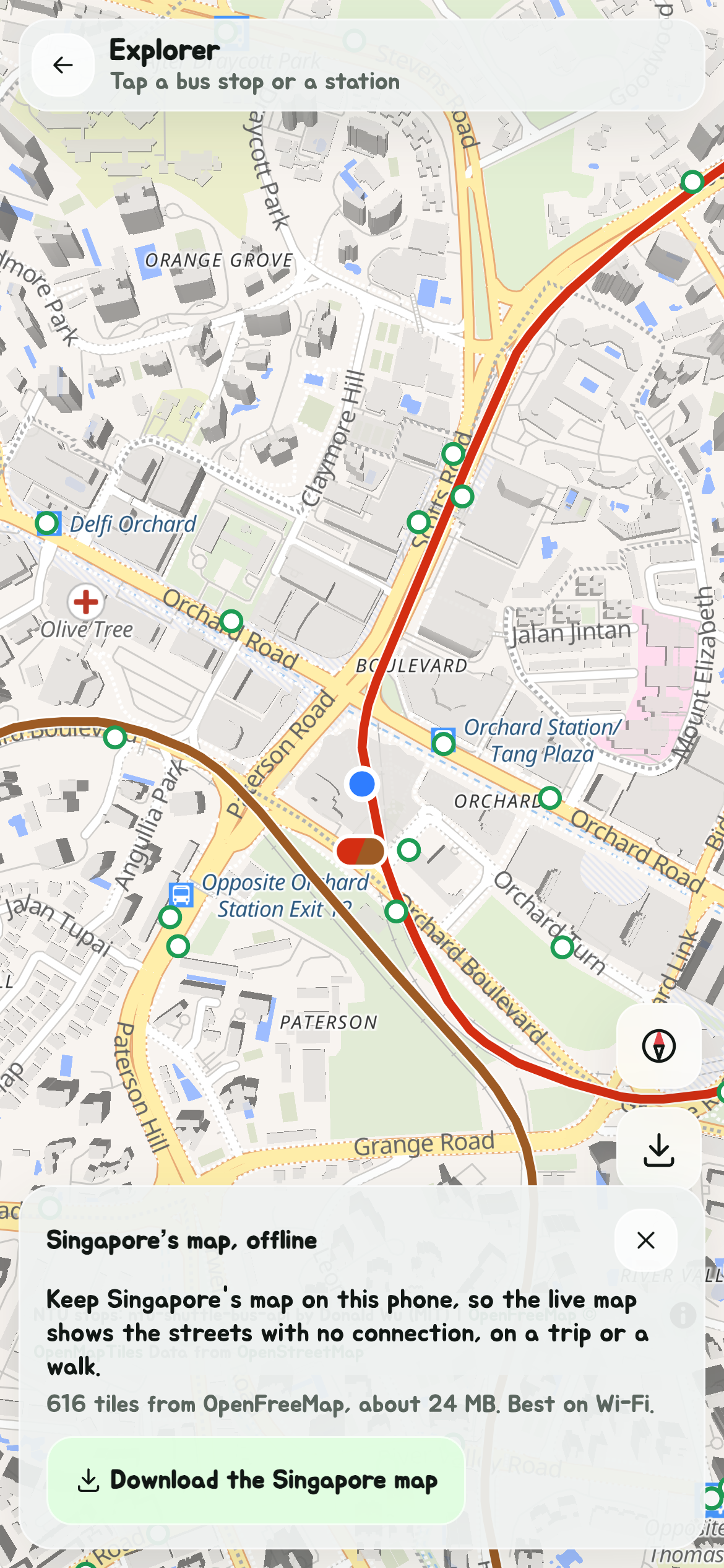
Tap the download button at the bottom right of Explorer for Singapore's map, offline. It says how many map tiles that is and roughly how big; tap Download the Singapore map, best on Wi-Fi. Once it's saved, Explorer and the live map show Singapore's streets with no connection, on a trip or a walk, and Explorer stays in the Edge Tray offline.
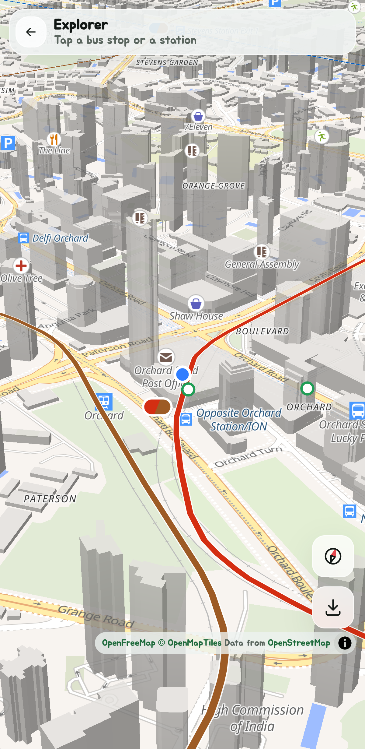
The saved map goes right down to street level. Tilt it with two fingers and the buildings stand up in 3D, with every label, just as they do online.
The same sheet then says when it was saved and how big it is, with Remove to delete it. When OpenFreeMap has a newer map out, Update map fetches it, and the one saved keeps working offline meanwhile.
Turn it off
Don't use Explorer? Turn it off in Settings, under Edge Tray buttons, and its button leaves the Edge Tray. Tap it again there to bring it back.