
Android app: advanced
Live map
The Android app's live map: walking, cycling and driving directions, your trip, traffic on a bus's way, and someone's shared trip, with buildings in 3D.
The live map shows where you are, and follows you as you go. It's drawn by the app over OpenFreeMap's map, with buildings that stand up in 3D when you tilt it. It fills the whole screen, and your phone's Back or its back arrow closes it.
Walk to a stop or place
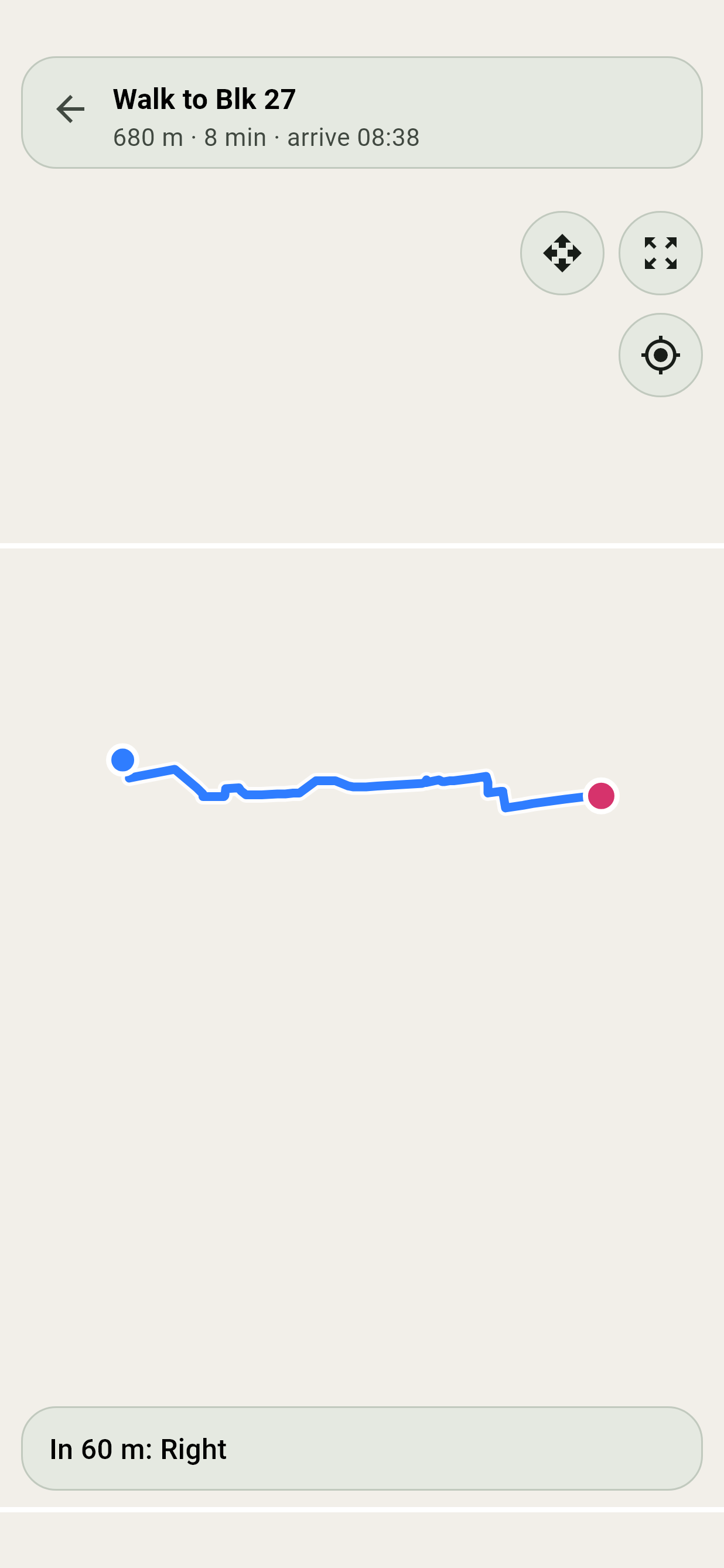
- On a stop's timings, tap Directions.
- In Navigate, on a walk in the way you've opened, tap Live map.
- In Navigate, under the ways, tap Walk it, Cycle it or Drive it, for the way on foot, by bike or by car.
The map draws the way there from where you are, along the streets, and the bar along the bottom says the next turn. At the top: how far is left, how long it takes, and when you'll get there. Go another way, and it finds the way from where you are. Cycle it and Drive it show how fast you're going too.
A walk takes footpaths, through estates, void decks and linkways, as well as pavements. Where they stop short of the place, the last stretch goes along the road, and a note says how much of it. It never goes along an expressway.
The first time, Android asks for your location: allow it. Without it, the map still shows where you're going, but can't follow you.
Off the route
Leave the route on a walk, a ride or a drive, and after a few steps the app finds the way from where you are, in the map and on a trip's walking, cycling or driving parts alike. A drive goes by which way you're heading, so it carries on from the road you're on, such as the KPE, rather than a street above it.
In a tunnel, or with weak GPS
When the GPS stops, as it does in the KPE and MCE tunnels, your dot keeps going along your route, paler, and the bar at the foot says No GPS here, so this is an estimate. The next turn, the distance and the arrival time keep going with it. As soon as the GPS is back, your dot goes to where you really are, and the app finds a new way if you've left the route.
The estimate starts from how fast you were going. The phone's accelerometer then tells when you've stopped, as in a jam, and when you pull away, and allows for braking once it's learned which way the phone faces. It's only ever an estimate, and it runs while the app is open. It never says you've arrived, and it never sets off a Get Off Alert. Trains follow their track by the time each ride should take.
Move the map
- Drag with one finger, or two going the same way, to move it. That stops it following you.
- Pinch to zoom, and twist two fingers to turn it. Neither stops it following you.
- The target button comes back to you and follows again.
While it follows you, your dot stays in the middle of the screen, and its arrow turns with your phone's compass.
Tilt and turn it
Hold the button with the four arrows, beside the side buttons, and drag it: up and down tilt the map, and left and right turn it. Close in, the buildings stand up in 3D, which helps tell which block is which. It doesn't stop the map following you. Tap the compass in the corner to put north back at the top.
Turn the map with you
The compass button turns the map so the way your phone points is up. Tap it again to put north back. It's there on your own walk or trip, not on someone else's shared trip.
See the whole way
Show the whole route, the corners button, shows the whole way at once.
Your trip on a map
While a trip runs, open its screen from the trip bar, and tap the map button at the top. The map shows the whole trip: each ride in its own colour with its stops, each walk along the streets to take, where you change, and where it ends, with you on it. A bus ride follows the roads the bus takes, and a train ride its line's track, and underground your dot moves along it by the time each ride should take.
Tap a stop or station on the trip for its card, as in Explorer.
Traffic on a bus's way
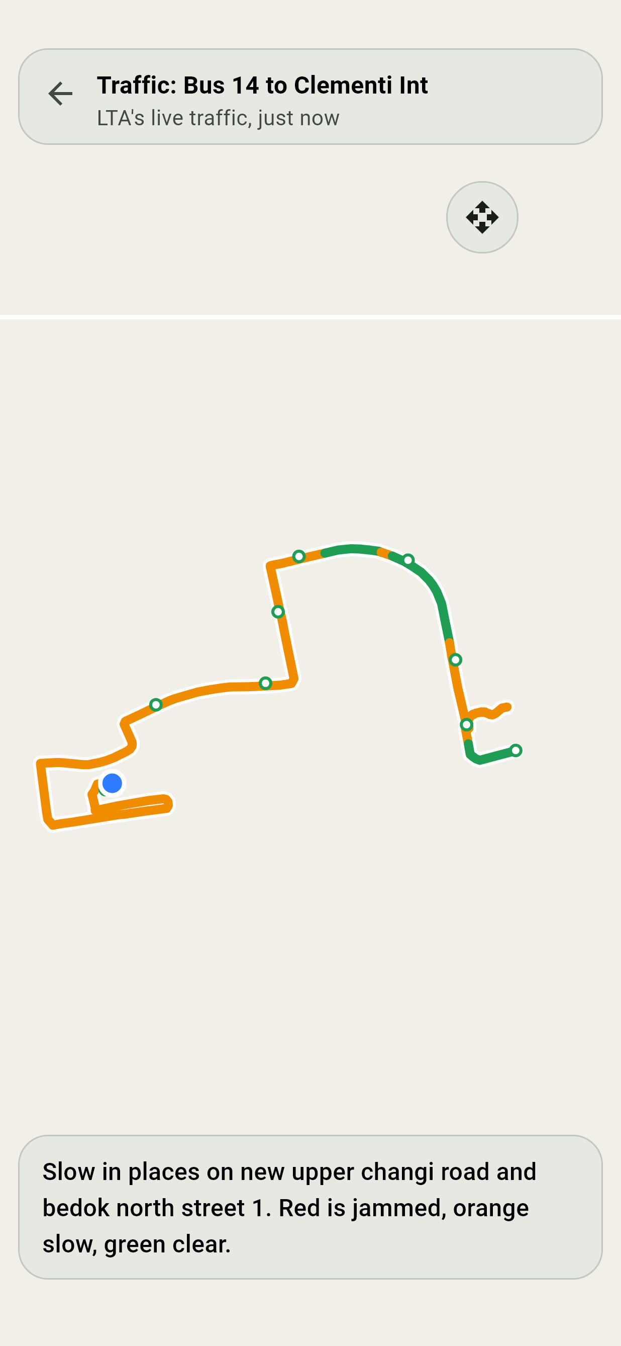
Wherever the app says a bus is slowed by traffic, in Navigate or on a trip, tap See it on the map for why: the bus's road, coloured by LTA's live speeds. Once the speeds are in, the map closes in on the slow and jammed stretches and any accidents or breakdowns.
- Green: moving freely.
- Orange: slow.
- Red: jammed.
Accidents, breakdowns and roadworks on its way are red dots: tap one for what LTA says about it. Along the bottom, the map says which roads are slowest, and how long ago LTA's traffic was updated.
Follow someone's trip
When someone shares their ETA with you, their link opens Live progress: when they'll arrive, which bus or train they're on, and their stops ahead, updating by itself. Live map shows their dot moving along their trip, and Directions there plans your own way to where they're going.
Offline
The map keeps what you look at. For all of Singapore, right down to street level with the buildings in 3D, save it from Explorer.
In a small window
Leave the app with the live map open, and it shrinks into a small window over your other apps. See Picture-in-picture.